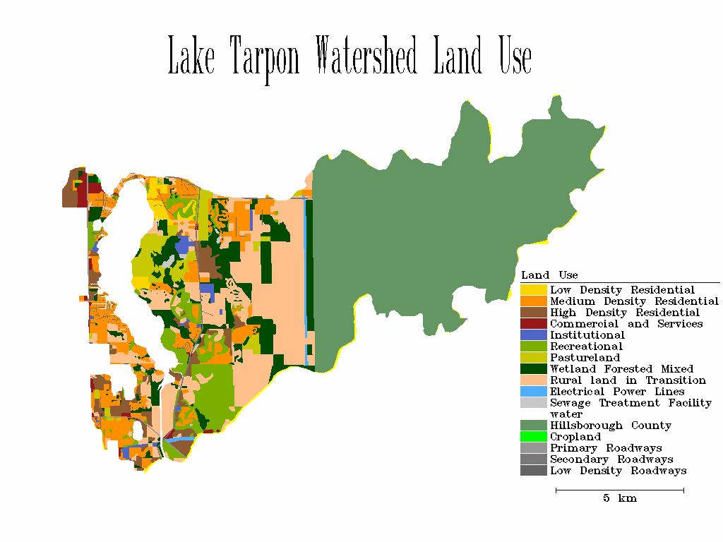
 Lake Tarpon Landuse Map
The Lake Tarpon Management Model was developed to analyze the effects of basin landuse changes on lake eutrofication. Basically the LTMM is an integrated surface water model with a receiving water quality model. The surface water model simulated the runoff and landuse nutrient loadings. The recieving water quality model used the results of the basin runoff modeling to determine the effect of the non-point source loadings would have on the lake. The results of the water quality simulations would be based on TSI or a trophic state index. The TSI is an indicator from 1 to 100 that describes the over-all water quality. Below are a sampling of GIS maps that were used as model input or displays of model output (TSI).
 Lake Tarpon Bathemetry and Sediment Distribution Map
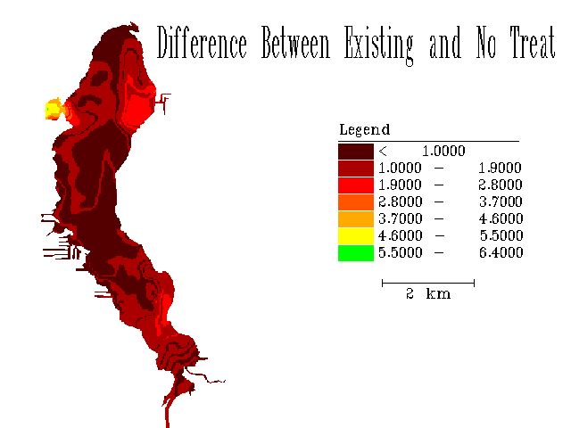 Lake Tarpon TSI Difference Map
 Go To Engineering Home Page
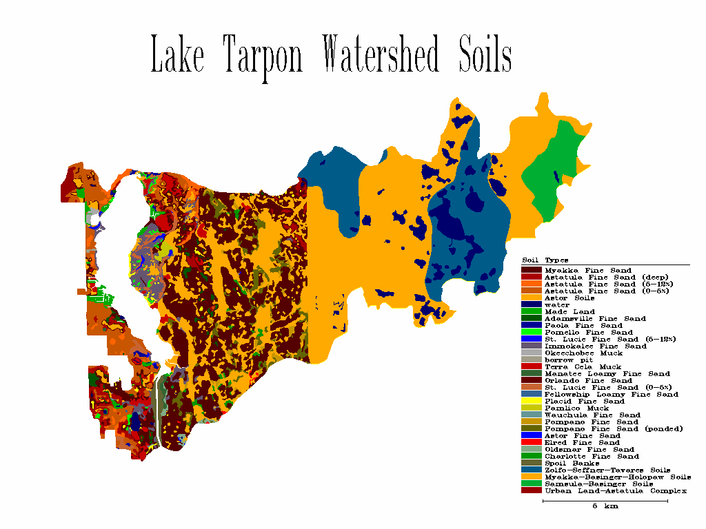 Lake Tarpon Soils Map
 Lake Tarpon Topography Map
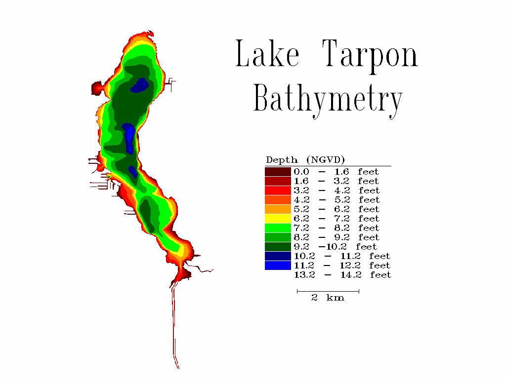 Lake Tarpon Bathemetry Map
 Go To USF Home Page