Little
Manatee River Data Collection / Monitoring Plan

SURFACE WATER MONITORING PLAN
This plan summarizes surface water monitoring performed to supplement existing
hydrologic data used for the Little Manatee
River Watershed Management Study. The monitoring plan was
developed following review of existing data collected under Task II of
the Scope of Services and the identification of additional data needs.
The intent of monitoring in the basin is to gather data to complete information
requirements for most of the major tributaries within the watershed. This
data is required to calibrate and verify hydrologic and hydraulic models
used in the study.
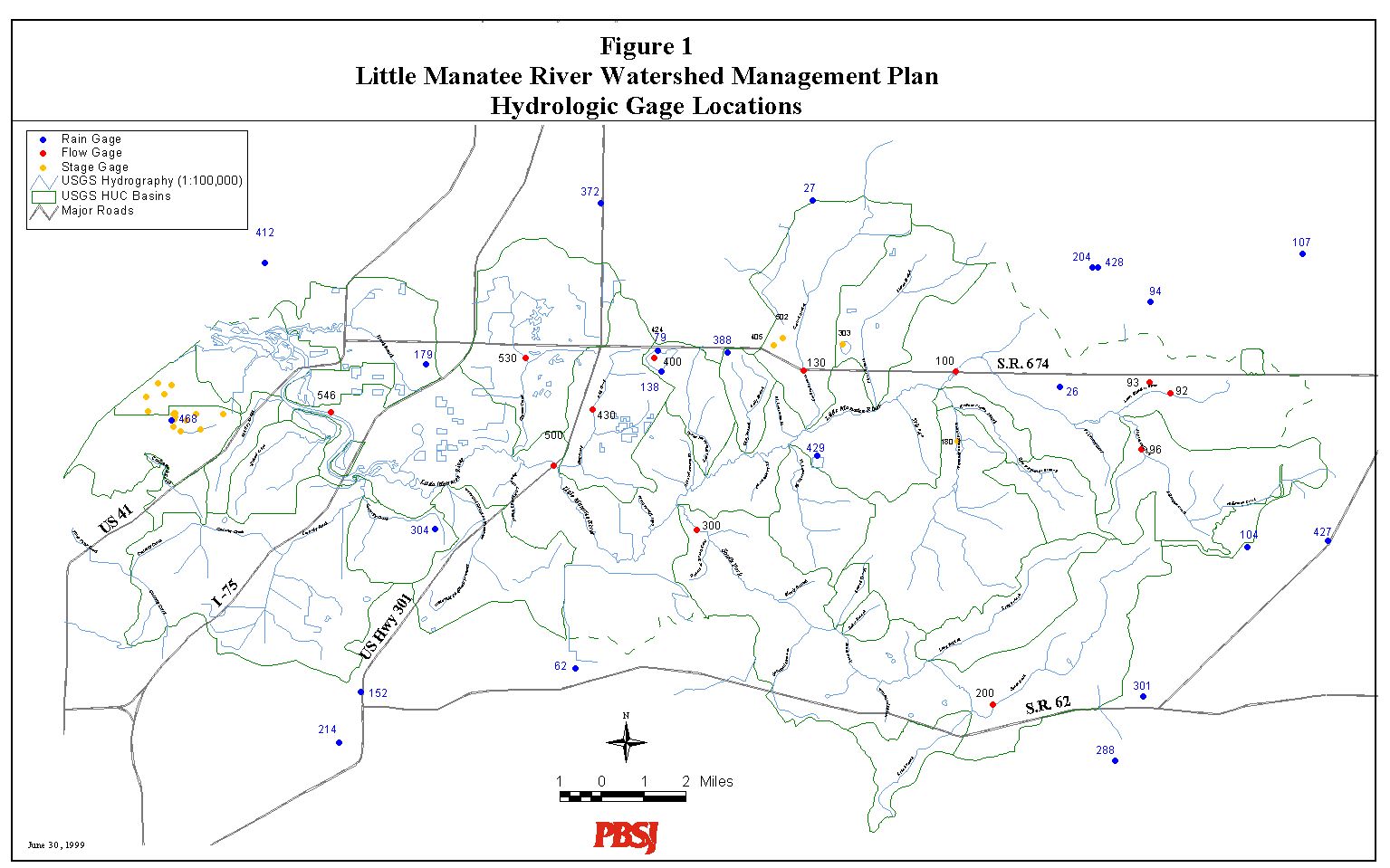
The study team has identified existing and historic surface water monitoring
sites throughout the basin. Figure
1 shows the location of hydrologic monitoring sites in and around the
Little Manatee River watershed, including rainfall, stage and discharge
gages. Table 1 summarizes information
for ten (10) historic and two (2) active
USGS
gages in the watershed. Table 2 contains
a description of active
SWFWMD
daily rainfall gages located in the watershed. Records for these
gages were collected and reviewed for suitability in calibration and verification
of the hydraulic model. The review resulted in identifying four potential
storm events, three of which may be used for these purposes.
Although historic information is available for a large portion of the
watershed, a need for additional hydrologic information exists. Monitoring
has been initiated to supplement the existing gage data. Stream flow
gages have been installed at three (3) new sites in the watershed, including
Cypress
Creek, Dug
Creek and the main channel of the Little
Manatee River. In addition, precipitation gages
have also been installed in the watershed. Information about these stations,
as well as up-to-date
data are available via the internet at http://cmhas.eng.usf.edu/projects/lilman/.
Monitoring Details
The three additional data collection stations: Cypress
Creek, Dug
Creek and the main channel of the
Little
Manatee River were equipped with recording stage gages and recording
doppler velocity meters. A flow rating table for each cross
section is being developed using manual periodic flow measurements taken
when the gages are serviced and during high flow periods. The stage
gages are standard float and pulley type with electronic shaft encoder
connected to an electronic data logger. The stage is recorded as
the average stage every 10 minutes. The insitu
velocity
meter is a vertical profiling ultrasonic doppler type. The average
velocity is recorded every 10 minutes. Manual flow measurements
taken at all stations will be used to correlate recorded stage and velocity
to flow at approximately weekly intervals in the beginning followed by
only large events later. Differences in channel velocity across the
cross-section especially at flood stages will require further correction.
These flow measurements will be performed using standard partitioning techniques
using a Marsh McBirney hand-held velocity meter. Rain data is collected
with a standard tipping bucket rain gage (NWS type). The data
is summed and stored in 5 minute intervals. The logger can store
277 days using the 5 minute interval. All gages and equipment will
be maintained on an approximately weekly schedule.
Center for Modeling Hydrologic and Aquatic Systems
Last modified on Monday, September
7, 1999