![]()
![]()
 |
  |
 |
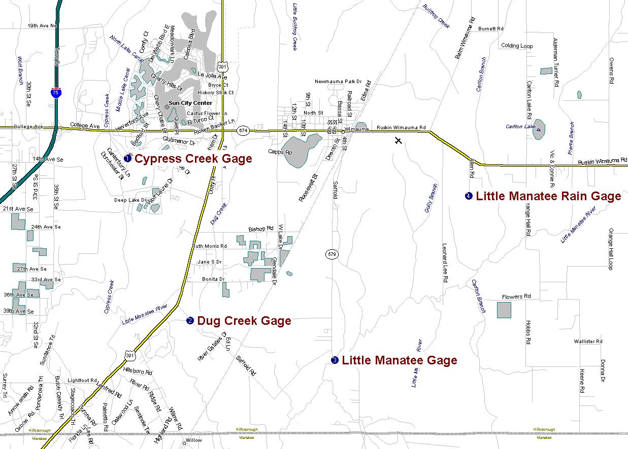
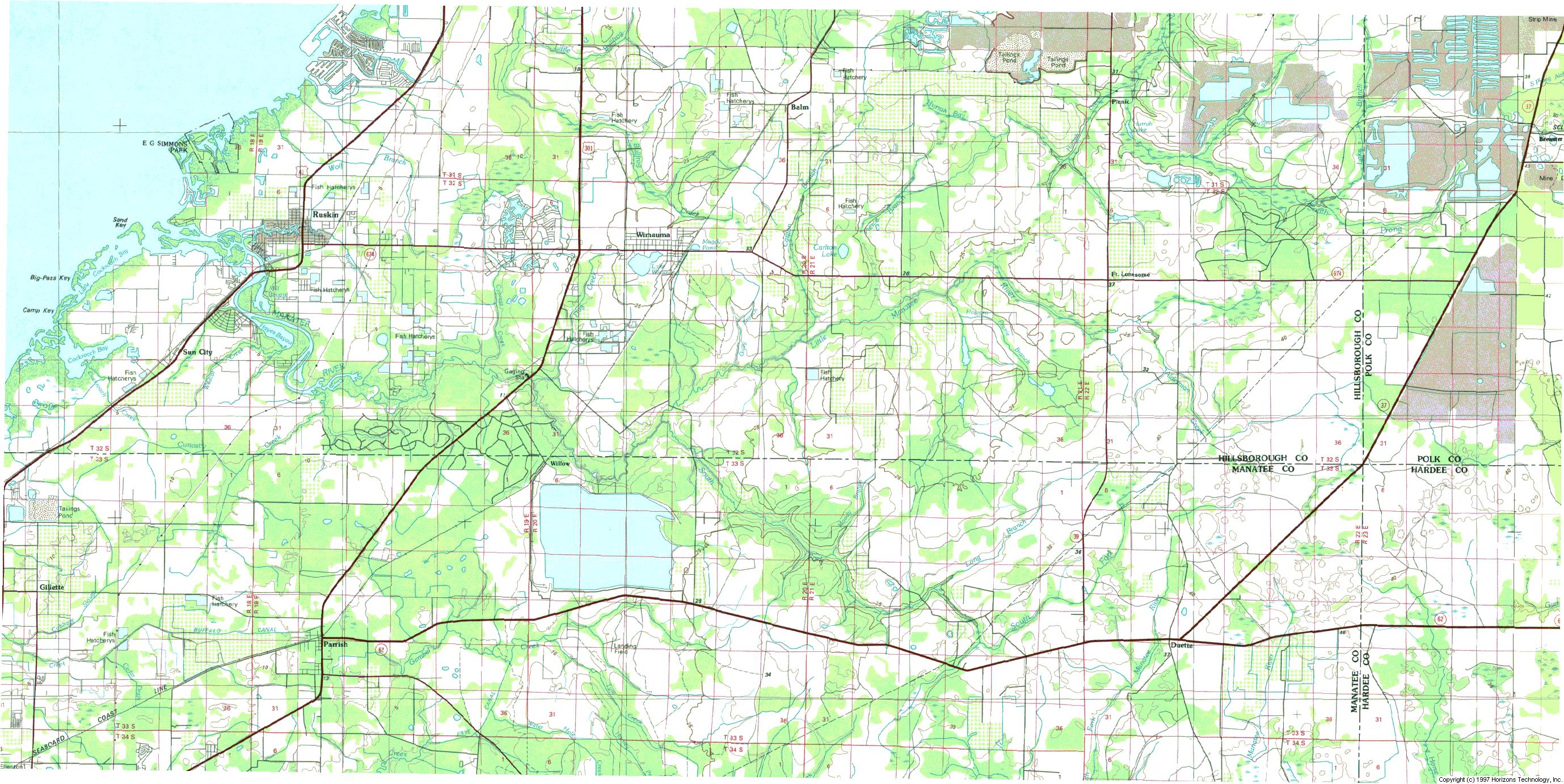
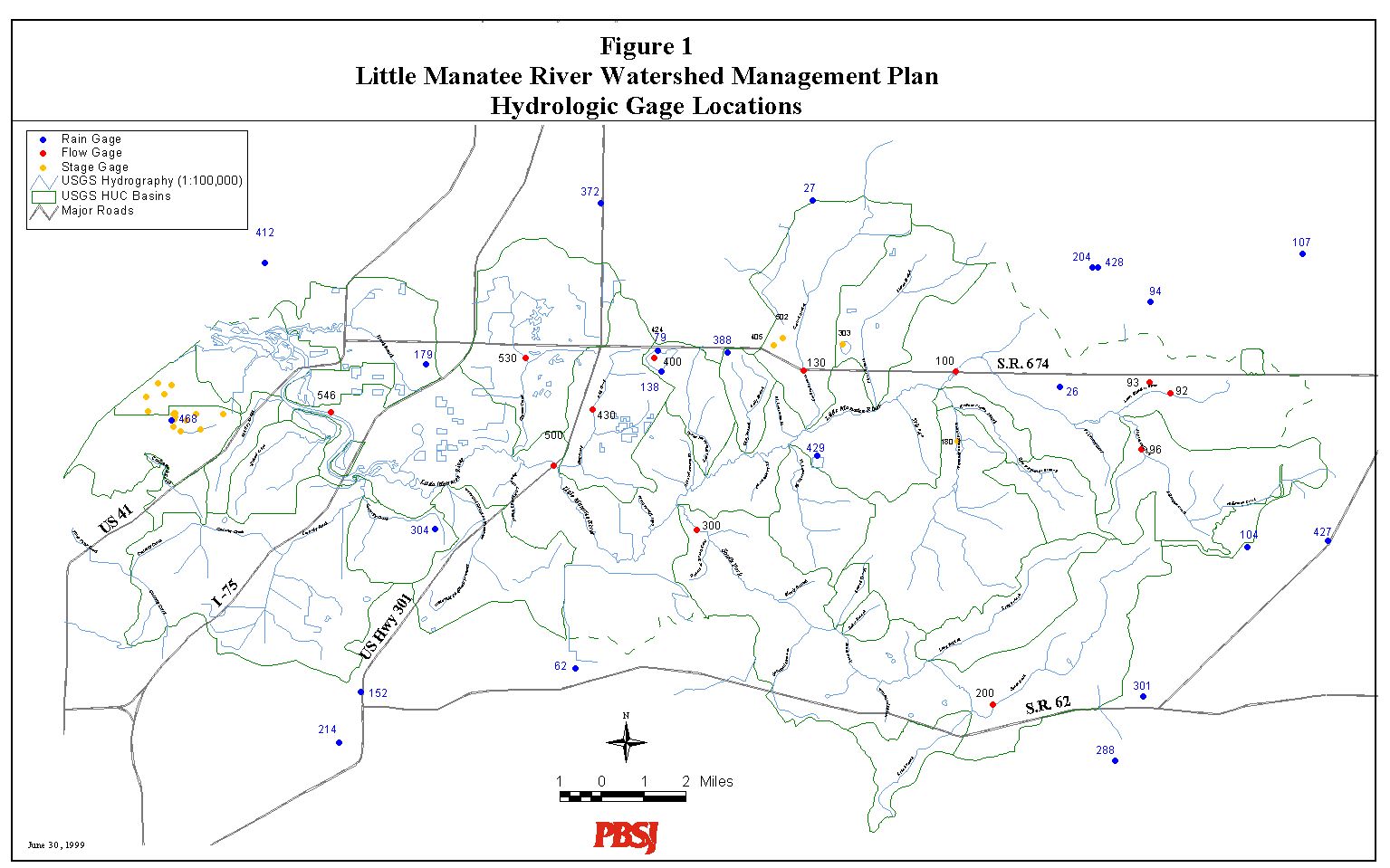
Project Summary. The Little Manatee River is located in southern Hillsborough County. This project includes the collection of precipitation, water level and streamflow data and the analysis of this and other data for calibration of a floodplain assessment model. The work is being performed for the Hillsborough County Stormwater Management Department under subcontract to PBSJ. Three stations were selected in previously un-gaged tributaries of the Little Manatee River. The three stations are Cypress Creek in Sun City Center, Dug Creek and Saffold Road, and Little Manatee River at 579. The field equipment includes stage recorders, insitu vertical profiling ultrasonic doppler velocity meters and tipping bucket electronic rainfall gages. Periodic flow measurements along with gage maintenance and data retrieval will be conducted over a three to four month period. A monitoring plan is available including a listing of available USGS data, selection of potential calibration periods, preliminary data analysis and a station location map.Monitoring PlanUSGS Data
- USGS Real Time Data Little Manatee near Wimauma (02300500)
- Historical Data within the Little Manatee basin
Basin Maps
- Road Map of Manatee Basin with data collection stations
- Quad Map of Manatee Basin
- GIS map of USGS stations
Photographs of Equipment and StationsInstalled Stations
Preliminary Data Collected at Stations
![]()
Center for Modeling Hydrologic and Aquatic Systems
Last modified on Monday, September 6, 1999